Please select your home edition
Edition
J Composites J/99

C-MAP announces launch of new website for recreational boaters

by Andrew Golden 18 Jun 2020 01:38 PDT
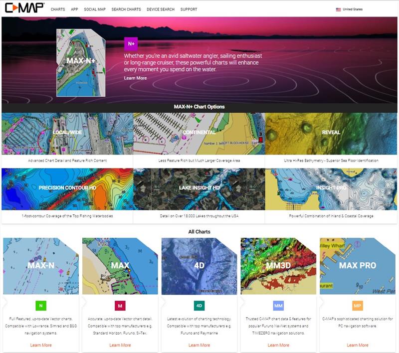
C-MAP launch of new website © Andrew Golden

C-MAP, a leader in digital marine cartography and cloud-based mapping, announced today the launch of the new C-MAP website catered to recreational boaters.

The new website, www.c-map.com, features rich content covering the entire C-MAP range, is optimized for mobile devices, and delivers an enhanced user experience - making it easier for consumers to find the chart they need via new location, chart or device compatibility searches.

Consumers who want to find a chart by geographical location can search by MY Area, which will show available charts in and around the consumer's location or area of their choosing. Clicking on any of the charts in the search results, provides a detailed product description of the chart.

The new Charts search gives consumers an overview of different chart technologies available, along with an at-a-glance chart comparison guide.

One of the most significant features of the new site is the capability to filter a search by device compatibility, under Devices. This removes the hassle of chart comparison tables or conducting online searches about device compatibility, by providing a list of compatible chart options based on consumer chartplotter brand and model.

"We are excited about the launch of the new C-MAP website," said Knut Frostad, CEO, Navico. "The new site not only provides a more enjoyable user experience, but also better serves consumers by making it easier for them to quickly find the chart that will meet their boating needs."

The site also includes a Dealer Locator, and a new Buy Now function that makes purchasing a chart on the site fast and easy, ensuring the smoothest possible consumer experience.

For more information about C-MAP or its entire line of marine cartography products, please visit www.c-map.com.

Related Articles

C-MAP app now with crowd-sourced Genesis layer
As well as across Lowrance®, B&G® and Simrad® apps powered by C-MAP charts C-MAP®, a leader in digital marine cartography and cloud-based mapping, has made its crowd-sourced mapping data called “Genesis” available on the C-MAP navigation app this month, as well as across Lowrance®, B&G® and Simrad® apps powered by C-MAP charts. Posted on 23 Jun 2022
Latest update for popular C-MAP navigation app
The updates provide even more features to one of the most highly rated marine navigation apps C-MAP®, a leader in digital marine cartography and cloud-based mapping, launched a range of key updates for free and premium subscribers of its C-MAP app this month, for both iOS and Android. Posted on 17 Feb 2022
C-MAP App introduces enhanced chart quality
Latest version of app for boaters, anglers, sailors and water-lovers unveiled C-MAP®, a leader in digital marine cartography and cloud-based mapping, unveiled its latest app for boaters, anglers, sailors and water-lovers alike this week including a Premium version loaded with new mapping features Posted on 10 Jun 2021
C-Map® new charts introduce global shaded relief
New Discover™ and Reveal™ replaces, simplifies Max-N+ range C-MAP, a leader in digital marine cartography and cloud-based mapping, has today launched a re-designed, simplified charting portfolio for Lowrance®, Simrad® and B&G® chartplotter with the introduction of C-MAP Discover and Reveal. Posted on 8 Mar 2021
New HDS Live C-MAP Contour+ Preloaded Chart
New release includes 1-Foot Contours on 15,000+ U.S. Lakes and 9,400 Canadian Lakes C-MAP®, a leader in digital marine cartography and cloud-based mapping, announced today the next generation of C-MAP Contour+ charts preloaded in HDS LIVE fishfinder/chartplotters. Posted on 2 Feb 2021
C-MAP South Carolina Precision Contour HD Chart
1-foot contours and custom depth shading helps anglers find fishing areas with ease C-MAP®, a leader in digital marine cartography and cloud-based mapping, announced today the release of the latest in its series of digital fishing map cards, Precision Contour HD - South Carolina. Posted on 12 Nov 2020
C-MAP rebrands flagship Nautical Navigation App
Bringing it further in line with the brand's portfolio of charting products C-MAP, a leader in digital marine cartography and cloud-based mapping, has renamed and enhanced its Embark App to the C-MAP: Boating App, bringing it further in line with the brand's portfolio of charting products, services and identity. Posted on 7 Sep 2020
C-MAP launches Web Map Tiling Service (WMTS)
C-MAP WMTS allows companies to build their own map-aware applications C-MAP, a leader in digital marine cartography and cloud-based mapping, announced today the launch of the C-MAP Web Maps Tiling Service (C-MAP WMTS) for developers. Posted on 8 Jan 2020
C-Map releases NC Precision Contour HD Chart
Find North Carolina fishing areas faster with 1ft contours C-MAP®, a leader in digital marine cartography and cloud-based mapping, announced today the release of a new chart card in its series of digital fishing map cards, Precision Contour HD - North Carolina. Posted on 12 Jul 2019
C-MAP announces new reveal charts for East Coast
Plus ultra high-resolution bathymetric imagery of the sea floor C-MAP Reveal cartography offers all the navigation data and capability of a C-MAP MAX-N+ card, plus ultra high-resolution bathymetric (HRB) imagery of the sea floor, including the clearest view of structure, wrecks, isolated reefs and ledges. Posted on 8 Jul 2019
North Sails Performance 2023 - FOOTERRS Sailing 2021 - FOOTERJ Composites J/45